Trail Walking Welschnofen - Nova Levante - König Laurin Tour : Rosengarten et Karer See - Photo

König Laurin Tour : Rosengarten et Karer See

© OpenStreetMap contributors
Length
Length
11.3 km
Max alt
Max alt
2335 m
Uphill gradient
Uphill gradient
157 m
Km-Effort
Km-Effort  
15.9 km
Min alt
Min alt
1539 m
Downhill gradient
Downhill gradient
895 m
Boucle
Boucle
No
Creation date :
2023-07-23 08:52:41.482
Updated on :
2023-07-30 11:06:36.463

(0 Reviews)

Walking
Walking
4h10
Difficulty : Medium

Scan this QR Code to open this trail in the SityTrail application

FREE GPS app for hiking

Logo SityTrail SityTrail

IGN / Geographical institutes

Download SityTrail from the App Store Download SityTrail from Google Play

Logo SityTrail SityTrail World

The world is yours!

Download SityTrail from the App Store Download SityTrail from Google Play Download SityTrail on Huawei AppGallery

About

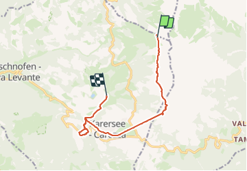
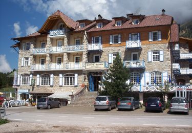
Trail Walking of 11.3 km to be discovered at Trentino-Alto Adige/Südtirol, South Tyrol, Welschnofen - Nova Levante. This trail is proposed by VacheKiri67.

Description

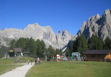
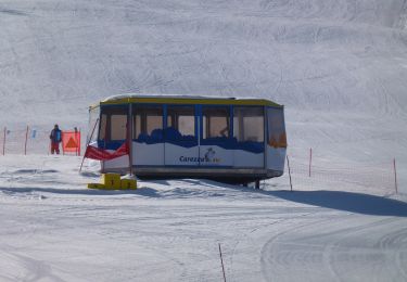
Faite le 23/07/2023. Montée en télécabine depuis Welschnofen. Nécessite le ticket à la journée "Rosengarten Pass" pour emprunter les 7 trajets en télécabines et télésièges du parcours.
Ce parcours demande cependant "d'avoir le pied sûr" et de ne pas être sensible au vertige à certains endroits.
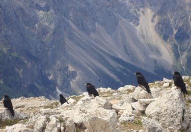
Randonnée magnifique pour découvrir le Rosengarten et le Karer See. Le sentier d'approche vers la Paolinahütte est particulièrement beau.

Elevation profile

Photos

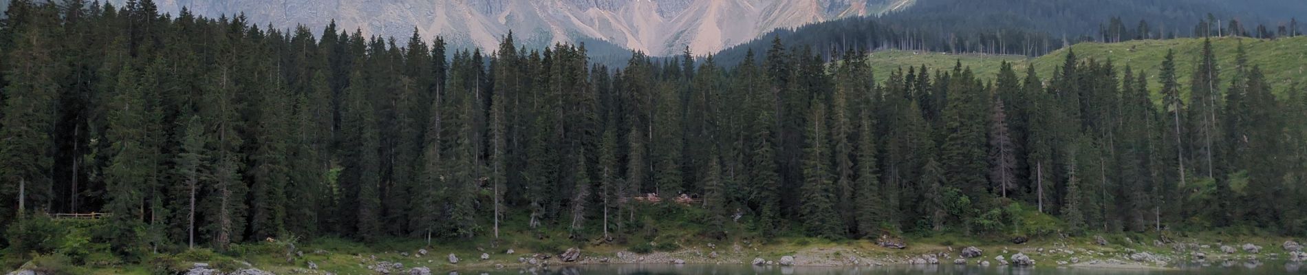
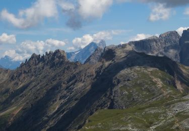
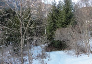
81 photos in total. Please click on a photo to see them all in the gallery.

Positioning

Country:
Italy
Region :
Trentino-Alto Adige/Südtirol
Department/Province :
South Tyrol
Municipality :
Welschnofen - Nova Levante
Location:
Unknown
Start:(UTM)
700629 ; 5146484 (32T) N.

Trails nearby

Trail On foot Tiers - Tires - (SI C17N) San Cipriano Tires - Rifugio Bolzano - Photo
On foot
PRO

On foot

Medium
Tiers - Tires, Trentino-Alto Adige/Südtirol, South Tyrol, Italy
8.1 km | 22 km-effort
4h 58min
No
Trail On foot Welschnofen - Nova Levante - (SI C16N) Bivio Rifugio Coronelle - San Cipriano Tires - Photo
On foot
PRO

On foot

Easy
Welschnofen - Nova Levante, Trentino-Alto Adige/Südtirol, South Tyrol, Italy
10.9 km | 16.4 km-effort
3h 44min
No
Trail On foot Tiers - Tires - (SI C17N OLD) San Cipriano Tires - Rifugio Bolzano - Photo
On foot
PRO

On foot

Medium
Tiers - Tires, Trentino-Alto Adige/Südtirol, South Tyrol, Italy
7.7 km | 23 km-effort
5h 8min
No
Trail On foot San Giovanni di Fassa - Vial de la Feide - Photo
On foot
PRO

On foot

Easy
San Giovanni di Fassa, Trentino-Alto Adige/Südtirol, Provincia di Trento, Italy
3.3 km | 7.1 km-effort
1h 37min
No
Trail On foot Welschnofen - Nova Levante - N01 - Photo
On foot
PRO

On foot

Easy
Welschnofen - Nova Levante, Trentino-Alto Adige/Südtirol, South Tyrol, Italy
3.2 km | 8.4 km-effort
1h 54min
No
Trail On foot San Giovanni di Fassa - Dolomiti 21 - Photo
On foot
PRO

On foot

Easy
San Giovanni di Fassa, Trentino-Alto Adige/Südtirol, Provincia di Trento, Italy
3.4 km | 5 km-effort
1h 7min
No
Trail On foot Welschnofen - Nova Levante - IT-E552 - Photo
On foot
PRO

On foot

Easy
Welschnofen - Nova Levante, Trentino-Alto Adige/Südtirol, South Tyrol, Italy
4 km | 5.9 km-effort
1h 20min
No
Trail On foot Soraga di Fassa - IT-E556 - Photo
On foot
PRO

On foot

Easy
Soraga di Fassa, Trentino-Alto Adige/Südtirol, Provincia di Trento, Italy
3.3 km | 7.9 km-effort
1h 47min
No
Trail On foot San Giovanni di Fassa - IT-E517 - Photo
On foot
PRO

On foot

Easy
San Giovanni di Fassa, Trentino-Alto Adige/Südtirol, Provincia di Trento, Italy
10.1 km | 19.6 km-effort
4h 27min
No


Close
My subscriptions